Par for the course, I was up at 2am with an anchor alarm going off in my ear. When I turned on the GPS in the cockpit, it was obvious we were still stuck to the bottom, but swinging in the rising wind and swirly current more towards shore. The sounder mounted on the starboard (outside) hull was saying 35 feet. (When we first anchored, we'd been hanging in 100 ft). It's no telling what the port hull would have been reading--we don't have a transducer there. But I envisioned the reef top right there... I cranked the rudders to starboard to let the current take us out a bit, and that helped. It was high tide, so with our 3' draft and a 6' tidal range, we probably could have swung completely over the outer reef without a problem. But still... I dozed in the cockpit until it was time to wake Dave at 4:30.
So we were up at the crack of dawn again. We had 77 nm to go to get to Bitung. We motorsailed all day in light conditions, with both engines going at cruise speed, to make the 77 miles from Siang to Bitung. With our tiny 27 Hp Yanmars, we only motor at about 5-5.5 knots.
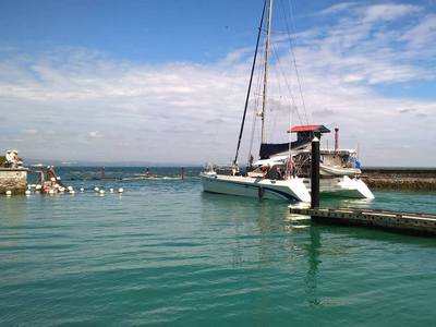
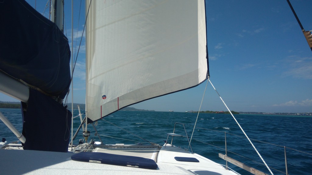
And we made it! With .5-1.5 knots of helping current, wind from the NNE-NE at 8-12 knots, and all our sails flying, we finally dropped anchor in the lee of Serena Besar next to Ariel IV and, another boat (Making Time), in Bitung Harbor at 6:15pm.
Ariel IV got into Bitung early yesterday, as they had continued to sail through the night. We have only had a brief conversation, but they have talked to Making Time and already gotten lots of diving and check-in advice. Eric & Birgitta from Ariel IV were going over to the other boat for drinks and info, so we're sure they'll have the full scoop this morning.
As usual in Indonesia, the anchoring dance has to do with finding someplace to anchor in less than 100 feet where you won't swing into a reef. Here it was made a little more complicated because there's a pretty stiff current, and we're not sure whether it reverses or not. We also wanted to anchor a good ways away from the two monohulls--cats and monos behave very differently in wind/current situations.
We must have done a good job because the anchor alarm didn't go off once all night! But at 5:30am, the intruder alarm in the cockpit went off...fortunately it was just a flapping towel. It's daylight enough now that I can see that we did a good job anchoring--we are positioned perfectly, and this is a pretty little spot, though there is quite a bit of current at times. Bastianos Dive Resort is about a mile south of us. After we get cleared in and talk to Making Time, we'll decide exactly where and how we'll go diving and whether we'll move to the "Bastianos" anchorage.
Serena Besar Anchorage: 01°27.47'N 125°13.83'E
Monday, March 27, 2017
Sunday, March 26, 2017
Day 5 - Sangihe to Siau Island
We had another long day hop planned, so we had to be up early. We planned a 5am departure. However, at 4am the drag alarm went off, and we were underway, with the mooring still tied on!! We had gusty winds to 20 knots in the harbor, coming in from the saddle in the mountain. I had put an anchor alarm with a very short radius. When we got the Garmin fired up, we could see that we were dragging the buoy along the shore, out to deep water. Fortunately our boat wasn't in immediate danger. We got the engines started quickly and the nav computer fired up. We were worried about dragging into another buoy behind us, and getting tangled up in that, but managed to avoid that.
The biggest problem was getting Dave's $50 fancy stainless steel clip off the mooring buoy. 45 minutes later we had finally backed towards shore and managed to drag the damned buoy back up the slope, so we could get the buoy hauled high enough to get the clip off. Otherwise, Dave was going to make me dive for it in the dark!! Fortunately, our Garmin chart was both detailed and accurate, which made the whole process easier.
But, it's a good thing we got underway early. Today's target was Siao island, about 55 miles away. We are hustling along trying to meet up with Ariel IV in Bitung (just had a radio contact with them... they are at sea, about 26 miles away from us, expecting landfall tomorrow morning for Bitung).
We had wind today from every point of the compass and from 0 knots to about 20 knots. We had helping current and adverse current. We were able sail for a few hours without the engines on, but because we were trying to keep our speed up, going dead downwind in light air, we ran one or both engines most of the day. We did make about 100 gallons of fresh water in 3 hrs of motoring...
Unfortunately a big squall hit about the time we arrived at Siao. So the spectacular view of the volcano was hardly visible through the rain.
We ended up anchoring in the lee of the two little islands on the SE side of Siao. We motored up to the big pier and tried to ask for suggestions on anchoring, after we found that the fishing boats we had thought to be anchored were really on moorings in 90 ft of water. They invited us to come in to the dock, but with a 6 ft tidal range and a concrete dock, we weren't doing that. The guy then said "right there". So we anchored just off the pier. There is a pretty good current running in the slot between the two islands. I'm not crazy about the anchorage, but it's getting dark and there's just no time to find an alternate spot. I tried to convince Dave to head out before it got full dark, and just make an overnight to Bitung, but he wouldn't budge. We could just sail slowly along and arrive in daylight. "Too much debris in the water, too many fishermen with unlit nets and FADs". (Yeah, but, you're not the one who will stand anchor watch all night...)
But it WAS nice to have a quiet dinner-and-a-movie without worrying about running over some poor fisherman.
Anchor position: 02°40.54'N 125°27.08'E
We are hoping for a quiet night, and plan an early departure at "first sparrow fart" (a British sailing term). We have 77 miles to go to the Bastianos anchorage at Bitung... another VERY long day. Most likely we will get in after dark.
Lessons (re-)learned today: (a) Never pick up someone else's mooring, no matter how new and hefty it looks. And no matter how badly you want to avoid anchoring. (b) If you want to sail, go on the windward side of the island!!
Saturday, March 25, 2017
Day 4 - Kawio to Sangihe, Tahuna Harbor
We had a great sail today from Kawio to Tahuna Harbor, Sangihe. No internet :p but great sailing conditions! Wind abeam mostly, seas reasonable, fast sailing (in a catamaran).
The last 10 miles along the west side of Sangihe were a bit challenging. The wind did its "cape effect" thing and accelerated. Fortunately we pulled in the Code Zero (our 10 kt sail) before the winds got over 15 knots. We clocked 27 knots several times. After we were a few miles south of the NW corner, we finally had to start the engines to maintain a consistent speed.
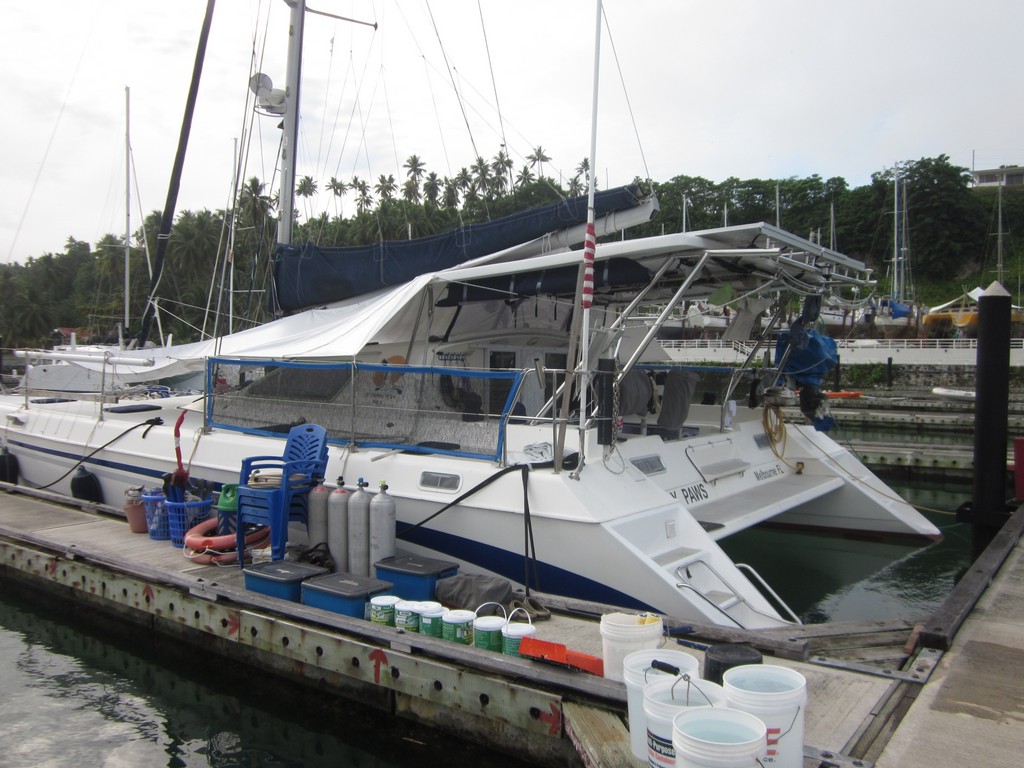
We weren't sure what we were going to find in the deep harbor of Tahuna. But as we motored in, we could see a few bright yellow moorings available. These are big yellow barrel-like moorings--yellow tarp wrapped with ropes around a big styrofoam barrel. The one we picked up was off the new dock (new 2016). It looked new--no slime and no barnacles, and the rope looked sturdy. But no idea what is on the bottom. We probably could have found a deep spot to anchor (70-80 ft), but Dave was convinced we'd be OK on the mooring overnight.
We probably could have gone into the dock had we been inclined. There is one boat on the dock, with enough room for another (dock is on N side of harbor, probably so new that it doesn't show in Google Earth), but just in from this waypoint.
Mooring 03-36.43N / 125-29.42E
Our plan is to head out in the morning, however, so we picked up the mooring vs trying to dock. No idea what's on the bottom, but we held fast in 5-20 knot winds, with a tight anchor alarm set. There are 3 other similar moorings further in the bay.
Our plan is to head out early tomorrow AM for Siau, and be in Bitung late on Monday
We heard Ariel IV on the radio tonight (only just). I think we bounced between 4143, 4054, and 6224. The loud signal wiping out 4143 was gone, and we just had harbor noise.
Not sure exactly where Ariel IV is... only heard "8kts" clearly and something about Sangihe, but we couldn't determine if they are sailing east or west of Sangihe. We expect to meet them in Bitung on Monday evening for a Tues am check-in party.
The last 10 miles along the west side of Sangihe were a bit challenging. The wind did its "cape effect" thing and accelerated. Fortunately we pulled in the Code Zero (our 10 kt sail) before the winds got over 15 knots. We clocked 27 knots several times. After we were a few miles south of the NW corner, we finally had to start the engines to maintain a consistent speed.
We weren't sure what we were going to find in the deep harbor of Tahuna. But as we motored in, we could see a few bright yellow moorings available. These are big yellow barrel-like moorings--yellow tarp wrapped with ropes around a big styrofoam barrel. The one we picked up was off the new dock (new 2016). It looked new--no slime and no barnacles, and the rope looked sturdy. But no idea what is on the bottom. We probably could have found a deep spot to anchor (70-80 ft), but Dave was convinced we'd be OK on the mooring overnight.
We probably could have gone into the dock had we been inclined. There is one boat on the dock, with enough room for another (dock is on N side of harbor, probably so new that it doesn't show in Google Earth), but just in from this waypoint.
Mooring 03-36.43N / 125-29.42E
Our plan is to head out in the morning, however, so we picked up the mooring vs trying to dock. No idea what's on the bottom, but we held fast in 5-20 knot winds, with a tight anchor alarm set. There are 3 other similar moorings further in the bay.
Our plan is to head out early tomorrow AM for Siau, and be in Bitung late on Monday
We heard Ariel IV on the radio tonight (only just). I think we bounced between 4143, 4054, and 6224. The loud signal wiping out 4143 was gone, and we just had harbor noise.
Not sure exactly where Ariel IV is... only heard "8kts" clearly and something about Sangihe, but we couldn't determine if they are sailing east or west of Sangihe. We expect to meet them in Bitung on Monday evening for a Tues am check-in party.
Friday, March 24, 2017
Day 3 - Sarangani to Kawio
If we had planned to make one overnight hop the last 100 miles to Sangihe, as we did the last two times we made this trip, we would have left late morning for a short overnight to Sangihe. However, Dave decided that he wanted to try to do this trip all in day-hops. So we decided to try to stop at Kawio Island, one of the first small islands south of the Philippine-Indonesian border. We had hove-to in the lee of this island last year, waiting for Soggy Paws Australia to catch up with the catamarans. But that was in the middle of the night. We had a good Google Earth picture of the island and felt we had pretty good anchoring options, if we arrived in daylight. So we got started from Sarangani at 6am. Thankfully no bad coral wraps, and we were away on time.
I was amazed to find that the strong Globe Cell signal persisted to almost 20 miles south of the southern tip of Sarangani. They must have that antenna mounted high up on the island with a good antenna!
Waves were choppy for the first 20 miles due to funny currents and wind. Same as every time we've been in this stretch of water.
We had a pretty nice sail, and helping current, and so arrived in the middle of the afternoon. We had good light and calm winds in the lee of the islands. We motored around and checked out two possible anchor spots. We ultimately decided to drop in a nice sand spot mostly in the lee (basically the sand spot between the two islands on the west side). It was a bit rolly at high tide but will be fine for an overnight stay.
We took a short snorkel late in the day (too late for much visibility). It was good to get in the water and get some exercise, but nothing worth shouting about, underwater-wise.
Dave was happy that we were spending the evening of our 10th wedding Anniversary at anchor, so I could serve him a nice dinner! We had a nice happy hour and a beautiful sunset, with even a little green flash.
Anchorage position: 04°39.60'N 125°25.86'E
We'll get up at 5am again tomorrow and make a day hop into Sangihe. Not sure whether we're going to spend one or two nights there.
We have been trying to keep a radio schedule with another boat, Ariel IV. The are in Samal and headed south to Bitung a few days behind us. We set the schedule up without much thought--around convenience vs best propagation. 7pm on 4143-49 has NOT been working out. There is a loud broadband signal on that freq that wipes everything out. 4054 sounds much better, so we'll stay on 4054 for 5 minutes and then switch to 6224. (Once Ariel IV got out of the marina, from behind the big island, we were able to talk to them on 4054).
Tuesday, March 21, 2017
Day 2 - Tubalan Bay to Sarangani Islands
We left Tubalan bay around 4:30 am and motored in calm winds and seas for a bit. Lots of fishermen and floats (looked like floating long-lines, not nets), but at 4:45am it was light enough to start seeing things. The wind started out light W and gradually clocked all the way around and picked up to an exhilarating 15-20 out of the ENE by the time we were approaching Sarangani. We detected no adverse current and some significant helping current after we rounded the hump in the west side of Gulf of Davao.
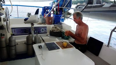
Dave Eating Breakfast and Reading Email In Sarangani
Because of wind direction, we opted to try a different anchorage than the two we've been in. We used the "Sarangani SW" waypoint that's in Terry's list (I think), from Shiralee. We dropped anchor in 20-30 ft (with some coral nearby to about 15 ft) in a sand spot. There are several nice looking spots along the west coast of Sarangani. With darkness fast approaching, we didn't have time to explore much.
There is a fair north-bound current where we are right now, holding us sideways to 7-9 kts of wind. It's fairly decent snorkeling here (clear water, sand and coral).
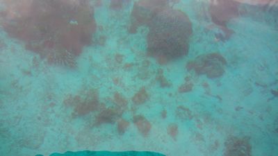
Clear Water!
We dropped our anchor at 05-25.084N / 125-27.547 E.
Decent Globe coverage here. I do see a Smart phone signal but no data.
As we motored in to the anchorage at Sarangani, the Philippine Coast Watch station on the southern tip of Mindanao called us by name (because we had our AIS on) and took us off to Ch 14 and asked us a few questions (this is normal, they call all passing ships they see on AIS). But now anyone with a VHF within 50 miles knows we are somewhere nearby, and that we are 2 Americans on an American boat, headed for Indonesia. On the other hand, we know the Coast Watch station can hear us from here, if we have an issue.
We spent another day anchored in this spot. Dave puttered around fixing things and Sherry took advantage of the last wisp of internet (at good speeds in our anchorage) to take care of business before we lost internet for about a week.
In the afternoon, we noticed a Philippines Navy Ship in the shipping lanes between Mindanao and Sarangani. We felt they were "guarding" us. The were sitting NW of Sarangani Islands and calling passing ships (like the Coast Watch station does), we saw them pretty much all day there.
We had another quiet night in the nice anchorage with great internet. (Globe Only).

Because of wind direction, we opted to try a different anchorage than the two we've been in. We used the "Sarangani SW" waypoint that's in Terry's list (I think), from Shiralee. We dropped anchor in 20-30 ft (with some coral nearby to about 15 ft) in a sand spot. There are several nice looking spots along the west coast of Sarangani. With darkness fast approaching, we didn't have time to explore much.
There is a fair north-bound current where we are right now, holding us sideways to 7-9 kts of wind. It's fairly decent snorkeling here (clear water, sand and coral).

We dropped our anchor at 05-25.084N / 125-27.547 E.
Decent Globe coverage here. I do see a Smart phone signal but no data.
As we motored in to the anchorage at Sarangani, the Philippine Coast Watch station on the southern tip of Mindanao called us by name (because we had our AIS on) and took us off to Ch 14 and asked us a few questions (this is normal, they call all passing ships they see on AIS). But now anyone with a VHF within 50 miles knows we are somewhere nearby, and that we are 2 Americans on an American boat, headed for Indonesia. On the other hand, we know the Coast Watch station can hear us from here, if we have an issue.
We spent another day anchored in this spot. Dave puttered around fixing things and Sherry took advantage of the last wisp of internet (at good speeds in our anchorage) to take care of business before we lost internet for about a week.
In the afternoon, we noticed a Philippines Navy Ship in the shipping lanes between Mindanao and Sarangani. We felt they were "guarding" us. The were sitting NW of Sarangani Islands and calling passing ships (like the Coast Watch station does), we saw them pretty much all day there.
We had another quiet night in the nice anchorage with great internet. (Globe Only).
Monday, March 20, 2017
Day 1 - Samal to Tubalan Bay
We finally escaped from Samal. Bittersweet, as we really love the marina, and are leaving some good friends behind.
Goodbye Holiday Oceanview Marina!!
We motored south with just the jib up until we passed the ferry terminal, then put up the bigger light air Code Zero. Still had to motor since wind was light behind us, and we needed to make a minimum of 5 knots to get in Tubalan (43 miles away) before dark. Even though we left at nearly exactly high tide, and expected a little helping current, it seemed we never had any favorable current...all day. We went on the west side of Samal, close in to shore.
Ahhh! It's great to be underway again!!
Almost on schedule (same as we experienced last year in May on this leg), around 2-3pm, near the south end of Talikud Island, the wind abruptly switched to SE and picked up. By late afternoon it was blowing 15-18 out of the SE, and we were sailing at 7.5 knots with no engines. Because the wind was from the SE and our course was due south for Tubalan Bay, we couldn't quite make the harbor at Tubalan with the wind from that direction. So we just kept up our best VMG, and sailed fast as close hauled as possible, ending up about 5 miles west of Tubalan Bay. Then we put down the jib and motorsailed close in along the coast in the lee as much as possible. Unfortunately, our Port engine starter wouldn't engage (Dave hasn't yet figured this out yet, but we do have a spare), so we were on one engine, going slowly (about 3.5-4kts into the 15-20 kts of wind, thankfully not much sea!)
Note: Today's spot forecast (GFS) shows a SE wind in the Gulf of Davao every afternoon for the next 10 days. So be forewarned to expect a strong land-induced SEly wind in the afternoons, maybe, going down the Gulf of Davao. It seems to die off to almost nothing at night, though.
So we ended up coming into Tubalan bay at dusk, racing darkness. Then we had a problem with the windlass/chain which took about 10 minutes to resolve. Now it was full dark, the wind was still blowing a little, even in the lee of the land, and we only had one engine. It is very difficult to close-in maneuver at slow speed in a cat with only one engine. We abandoned the idea of anchoring in our old (2014) anchor spot in the SE side of the bay, on a very narrow shelf, and headed for the SW side of the bay, where we had anchored last year with the Rally.
We had been in the bay enough times to feel OK motoring around slowly in the dark, with Dave on the bow, and me with the computer and OpenCPN, with both our 2014 and 2016 tracks in the cockpit. There is a large fish farm structure in the middle of the bay to the west side... just about where our CM93 charts show an anchor on the chart. But the spot we ended up anchoring, you could come to in a straight line from any part of the entrance (slowly, carefully, watching depthsounder and with a lookout on the bow) and clearly avoid the hazards of the fish farm to the west and a coral shelf coming out from the dividing point of the east and west lobes of the bay. (Note that the coral shelf on east side of the entrance extends a LONG way out from land. It is more or less correctly shown on the CM93 chart). Heading straight SSW into shore at 2 kts, when our depth sounder went abruptly from 120 ft to 35-40 ft, we dropped anchor. Probably in coral. We can see stakes to our south about 100 meters that probably mark a very shallow coral ledge.
Both Globe and Smart cell phone coverage here.
Anchor wpt: 06 30.0796 N / 125 34.2857 E
This anchorage wouldn't be good in the strong northerlies we've had this past week--might be better in the eastern lobe of the bay then. But it is OK for NE-S-NW. We are getting a little swell this morning that we think is probably related to tidal issues (I remember same thing last year). No wind overnight and we were drifting around in circles--there is a slight along-shore current here. Right now, wind is NNE about 7 kts and a little chop, but still fine.
There were two bars or houses ashore that we could hear music from about 7pm to 9:30 pm. One was Karaoke and another was techno music, both loud. But thankfully they shut down before 10pm. We locked up and set our cockpit movement alarm and slept well last night.
We were visited by a couple of guys in canoes about 9am this morning. They are fishermen in the village of Malita here (lots of small fishing boats and FADs all over). Neil Davis (one of the guys) spoke reasonably good English. We asked him about safety and Abu Sayyaf. He said this is a Christian village, a Christian area. And even when there are Muslims, they are good Muslims. He said the Jolo/Basilan area (SW Mindanao) has Muslims that came from Malaysia. These are the bad guys (he gave us what seemed like a tribe name, but I didn't write it down). The Muslims from Davao to Sarangani are different tribes--they are good guys. They migrated from Indonesia. He said we should not fear stopping along this coast. He asked if we wanted any food or water or "coconut wine". He also offered help from the village if we needed help with the starter problem. (Note, there is a bus that runs along the coast between General Santos and Davao, if you needed to hitch into Davao in an emergency).
If Dave can get the Port engine starter issue fixed today, the plan is to stay here today and head out about 4-5am tomorrow for the next day's hop... 67 miles from here... to Sarangani. We have a spare starter, so if the problem isn't fixable, we'll just swap in the spare starter and fix the problem later. Then we'd leave Sarangani about mid-morning on Wed for a Thursday arrival in Sangihe.
I contacted Jeffry Gaghana today via Facebook Messenger. He was the head of the Sangihe tourism department, and responsible for our Rally coordination, in 2014. But had been deposed by changing elections when we visited last year. He speaks good English and we met with him when we were back in Sangihe in 2016, plus have been FB friends for 2 years. I asked him if we stopped in Sangihe on our way to Bitung, would it be OK. I said nothing about staying on or getting off the boat. He thought it would be fine. Since we know where the ATM and the sim card shop is in Sangihe, I may convince Dave to sneak ashore and get some cash and a couple of sim cards, without bothering with any formalities. But even so, since we have the YachtERS cruising permit application and an Indonesian visa in our passport, I would think that even if an official approached us, we'd be OK by showing these and just stating that we're on the way to Bitung to do our formalities.

We motored south with just the jib up until we passed the ferry terminal, then put up the bigger light air Code Zero. Still had to motor since wind was light behind us, and we needed to make a minimum of 5 knots to get in Tubalan (43 miles away) before dark. Even though we left at nearly exactly high tide, and expected a little helping current, it seemed we never had any favorable current...all day. We went on the west side of Samal, close in to shore.
Almost on schedule (same as we experienced last year in May on this leg), around 2-3pm, near the south end of Talikud Island, the wind abruptly switched to SE and picked up. By late afternoon it was blowing 15-18 out of the SE, and we were sailing at 7.5 knots with no engines. Because the wind was from the SE and our course was due south for Tubalan Bay, we couldn't quite make the harbor at Tubalan with the wind from that direction. So we just kept up our best VMG, and sailed fast as close hauled as possible, ending up about 5 miles west of Tubalan Bay. Then we put down the jib and motorsailed close in along the coast in the lee as much as possible. Unfortunately, our Port engine starter wouldn't engage (Dave hasn't yet figured this out yet, but we do have a spare), so we were on one engine, going slowly (about 3.5-4kts into the 15-20 kts of wind, thankfully not much sea!)
Note: Today's spot forecast (GFS) shows a SE wind in the Gulf of Davao every afternoon for the next 10 days. So be forewarned to expect a strong land-induced SEly wind in the afternoons, maybe, going down the Gulf of Davao. It seems to die off to almost nothing at night, though.
So we ended up coming into Tubalan bay at dusk, racing darkness. Then we had a problem with the windlass/chain which took about 10 minutes to resolve. Now it was full dark, the wind was still blowing a little, even in the lee of the land, and we only had one engine. It is very difficult to close-in maneuver at slow speed in a cat with only one engine. We abandoned the idea of anchoring in our old (2014) anchor spot in the SE side of the bay, on a very narrow shelf, and headed for the SW side of the bay, where we had anchored last year with the Rally.
We had been in the bay enough times to feel OK motoring around slowly in the dark, with Dave on the bow, and me with the computer and OpenCPN, with both our 2014 and 2016 tracks in the cockpit. There is a large fish farm structure in the middle of the bay to the west side... just about where our CM93 charts show an anchor on the chart. But the spot we ended up anchoring, you could come to in a straight line from any part of the entrance (slowly, carefully, watching depthsounder and with a lookout on the bow) and clearly avoid the hazards of the fish farm to the west and a coral shelf coming out from the dividing point of the east and west lobes of the bay. (Note that the coral shelf on east side of the entrance extends a LONG way out from land. It is more or less correctly shown on the CM93 chart). Heading straight SSW into shore at 2 kts, when our depth sounder went abruptly from 120 ft to 35-40 ft, we dropped anchor. Probably in coral. We can see stakes to our south about 100 meters that probably mark a very shallow coral ledge.
Both Globe and Smart cell phone coverage here.
Anchor wpt: 06 30.0796 N / 125 34.2857 E
This anchorage wouldn't be good in the strong northerlies we've had this past week--might be better in the eastern lobe of the bay then. But it is OK for NE-S-NW. We are getting a little swell this morning that we think is probably related to tidal issues (I remember same thing last year). No wind overnight and we were drifting around in circles--there is a slight along-shore current here. Right now, wind is NNE about 7 kts and a little chop, but still fine.
There were two bars or houses ashore that we could hear music from about 7pm to 9:30 pm. One was Karaoke and another was techno music, both loud. But thankfully they shut down before 10pm. We locked up and set our cockpit movement alarm and slept well last night.
We were visited by a couple of guys in canoes about 9am this morning. They are fishermen in the village of Malita here (lots of small fishing boats and FADs all over). Neil Davis (one of the guys) spoke reasonably good English. We asked him about safety and Abu Sayyaf. He said this is a Christian village, a Christian area. And even when there are Muslims, they are good Muslims. He said the Jolo/Basilan area (SW Mindanao) has Muslims that came from Malaysia. These are the bad guys (he gave us what seemed like a tribe name, but I didn't write it down). The Muslims from Davao to Sarangani are different tribes--they are good guys. They migrated from Indonesia. He said we should not fear stopping along this coast. He asked if we wanted any food or water or "coconut wine". He also offered help from the village if we needed help with the starter problem. (Note, there is a bus that runs along the coast between General Santos and Davao, if you needed to hitch into Davao in an emergency).
If Dave can get the Port engine starter issue fixed today, the plan is to stay here today and head out about 4-5am tomorrow for the next day's hop... 67 miles from here... to Sarangani. We have a spare starter, so if the problem isn't fixable, we'll just swap in the spare starter and fix the problem later. Then we'd leave Sarangani about mid-morning on Wed for a Thursday arrival in Sangihe.
I contacted Jeffry Gaghana today via Facebook Messenger. He was the head of the Sangihe tourism department, and responsible for our Rally coordination, in 2014. But had been deposed by changing elections when we visited last year. He speaks good English and we met with him when we were back in Sangihe in 2016, plus have been FB friends for 2 years. I asked him if we stopped in Sangihe on our way to Bitung, would it be OK. I said nothing about staying on or getting off the boat. He thought it would be fine. Since we know where the ATM and the sim card shop is in Sangihe, I may convince Dave to sneak ashore and get some cash and a couple of sim cards, without bothering with any formalities. But even so, since we have the YachtERS cruising permit application and an Indonesian visa in our passport, I would think that even if an official approached us, we'd be OK by showing these and just stating that we're on the way to Bitung to do our formalities.
Saturday, March 11, 2017
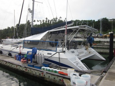
Painting the Deck with Not Really Kiwi Grip
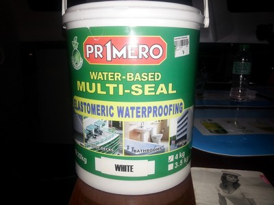
It all started when Dave heard while hanging out on "The Balcony of Knowledge" at Oceanview Marina about this local product that was "the same as Kiwi Grip but MUCH cheaper". (Kiwi Grip is a deck painting product made and marketed out of New Zealand. It has a great reputation, but is very expensive).
Almost Like Kiwi Grip
First, let me explain about The Balcony of Knowledge. There is no bar or restaurant at Oceanview Marina. However, there is a nice balcony and an "honor bar"--a refer stocked with beer, water, and sodas. And there's a killer view of the sunset (and a welcome breeze) from the balcony. So cruisers hanging out in the marina tend to congregate for a cold beer and a little breeze to watch the sun goes down. You can learn some amazing things on this balcony. Cruisers from all over the world are working on their boats in the marina, and they are happy to share their knowledge and their opinions.
The way I heard it, some cruiser had painted his deck with this stuff 10 years ago and was very satisfied with it. He told Marcel on s/v Mintaka San about this locally-available, inexpensive deck paint. Marcel went right down to the hardware store, bought the stuff, and put it on his deck. (Later, I directly queried the original guy, and he hadn't really used the Philippine product, but something very similar, in the general category of an "elastomeric roofing sealer".) Dave took a look at the job that Marcel did with it on Mintaka San, and liked what he saw. Meanwhile, he told another cruiser about it, who also put it on his deck.
Dave's favorite "deck shoe" is a pair of fancy Croc-like flip-flops. These are easy-on shoes, and comfortable on the foot. But deck shoes they ain't. And our deck on the new Soggy Paws isn't very grippy. When it gets wet, it's a little slippery, especially with Dave's favorite slick-bottomed shoes. So Dave has been wanting to do "something" with the deck. He had previously re-done the decks on the old Soggy Paws with epoxy and "sand", and he knew how much work it was to get a good finish and an even layer of sand. He did a little reading about Kiwi-Grip and how easy it is to apply, and he was hooked on the idea. I wasn't so sure.
I Googled for hours, trying to find someone else who had used THIS product on his deck. I couldn't find one. I did find out a lot of information about Kiwi Grip, which did sound like a wonder product.
The key to the whole process is a thick, latex-based "elastomeric" paint, and a special "loopy" roller that gives the paint texture. (If you buy the kit from Kiwi Grip, you get paint made for marine deck paint, the loopy roller, and detailed instructions). Basically, you goop on the paint, let it dry until it's almost tacky, and then roll it with the loopy roller, which makes a nice textured surface. By varying how thick the paint is and how long you let it dry before rolling it with the loopy roller, you can control how aggressive the textured surface is. Kiwi Grip strongly recommends practicing on something non-critical to get the technique right before starting on highly visible parts of your deck!
So we started stockpiling the Primero brand Elastomeric Roofing Sealer. The hardest part was finding enough white to mix with the light grey "Cosmic Sand" color to make the color a very very light grey. (Too dark, even a little dark, and the deck is blazing hot on bare feet). We scoured every hardware store and paint shop in Davao to accumulate enough paint (8 gallons in all) to do our deck. We were looking for a 3:1 mixture, so we had 6 gallons of white and 2 gallons of Cosmic Sand, at a cost of about $20USD per gallon. The loopy rollers were fortunately in stock at Citi Hardware (though we'd been offer the loan of a pair of Kiwi Grip rollers by another cruiser). (We ended up having to run down to Ace Hardware at the end and buy another 3 gallons of paint--and we could only find 2 gallons of white, so we ended up with about 1/3 gallon of Cosmic Sand left over).
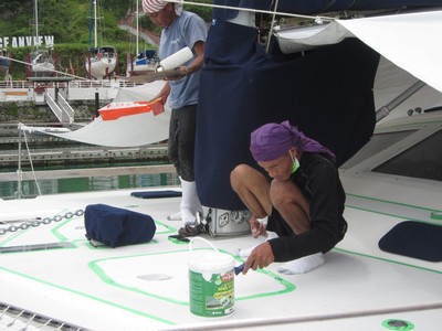
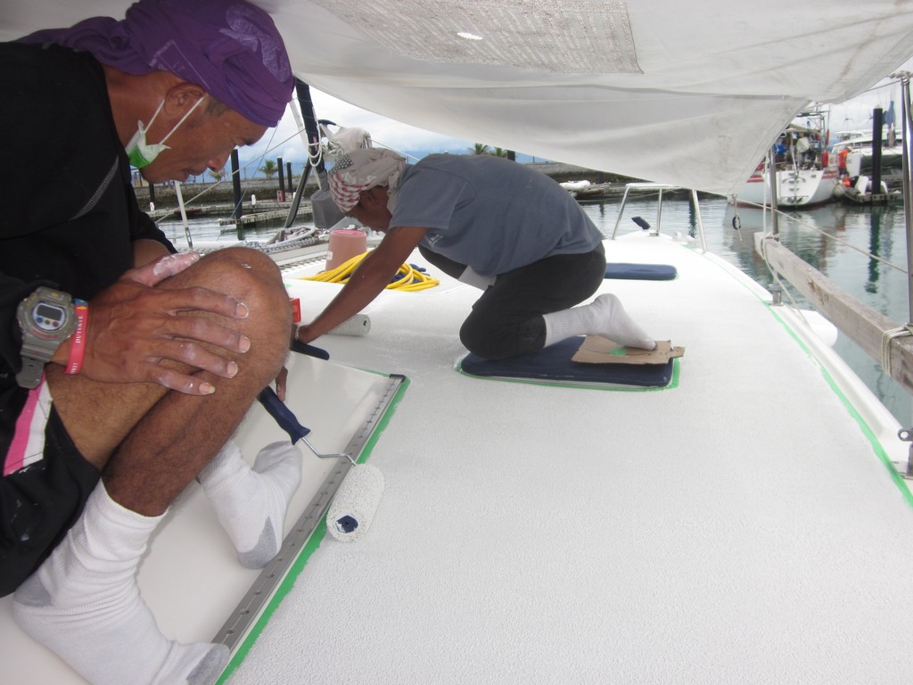
Since the paint is so thick, there's no tedious deck prep. You just have to make sure there's no greasy residue and no flakey bits on your old deck paint. Our helper Alex and another painter prepped our deck in one day. They scrubbed the whole deck on hands and knees with a stiff brush and soap and water. Then, with socks on to keep from making greasy spots on the deck, they taped off the non-nonskid areas with painters tape. Then they applied the paint in 3ft x 3ft sections. With the exception of one unexpected rain shower, the actual painting was complete in 3 days (port side, starboard side, cockpit area).
Clearing the Decks for Painting
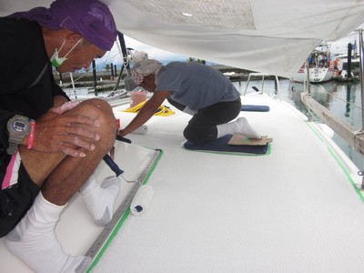
Alex and Kim Each Working on Small Sections of Deck
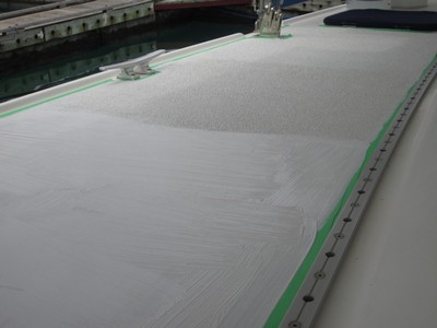
See the Goopy Wet Section, Unrolled, in the Foreground
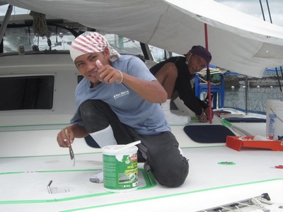
Alex Feeling Good About the Job
The rain shower... we were waiting for a couple of dry days to do the painting, and we were antsy to get going, so we got started a day early. The guys had just finished the 2nd section aft of the starboard bow, and a little rain cloud popped over the hill. It poured for about 15 minutes. Since it is latex-based (water based), all the paint they had just applied just washed off!! Once things dried out again the next morning, they just painted it again--no problems.
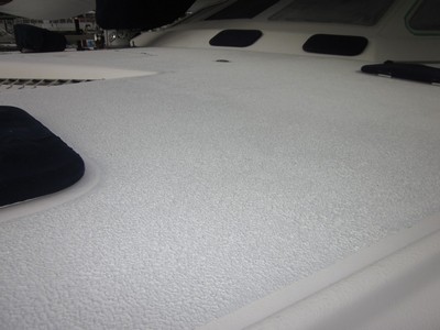
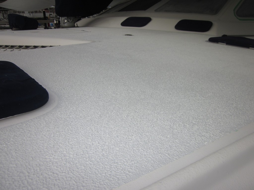
Finished Deck
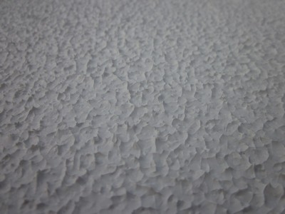
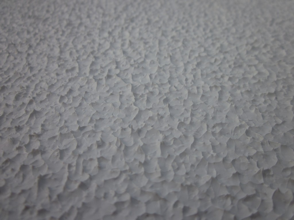
Our "Aggressive" Finish Up Close
It took a week for the deck to dry fully, since the paint was applied so thick. It IS grippy! Thank God Dave decided not to paint the actual seats in the cockpit area--it's much too "aggressive" for sitting on in a bathing suit.
We'll report back in a year to let you know how it has turned out.

First, let me explain about The Balcony of Knowledge. There is no bar or restaurant at Oceanview Marina. However, there is a nice balcony and an "honor bar"--a refer stocked with beer, water, and sodas. And there's a killer view of the sunset (and a welcome breeze) from the balcony. So cruisers hanging out in the marina tend to congregate for a cold beer and a little breeze to watch the sun goes down. You can learn some amazing things on this balcony. Cruisers from all over the world are working on their boats in the marina, and they are happy to share their knowledge and their opinions.
The way I heard it, some cruiser had painted his deck with this stuff 10 years ago and was very satisfied with it. He told Marcel on s/v Mintaka San about this locally-available, inexpensive deck paint. Marcel went right down to the hardware store, bought the stuff, and put it on his deck. (Later, I directly queried the original guy, and he hadn't really used the Philippine product, but something very similar, in the general category of an "elastomeric roofing sealer".) Dave took a look at the job that Marcel did with it on Mintaka San, and liked what he saw. Meanwhile, he told another cruiser about it, who also put it on his deck.
Dave's favorite "deck shoe" is a pair of fancy Croc-like flip-flops. These are easy-on shoes, and comfortable on the foot. But deck shoes they ain't. And our deck on the new Soggy Paws isn't very grippy. When it gets wet, it's a little slippery, especially with Dave's favorite slick-bottomed shoes. So Dave has been wanting to do "something" with the deck. He had previously re-done the decks on the old Soggy Paws with epoxy and "sand", and he knew how much work it was to get a good finish and an even layer of sand. He did a little reading about Kiwi-Grip and how easy it is to apply, and he was hooked on the idea. I wasn't so sure.
I Googled for hours, trying to find someone else who had used THIS product on his deck. I couldn't find one. I did find out a lot of information about Kiwi Grip, which did sound like a wonder product.
The key to the whole process is a thick, latex-based "elastomeric" paint, and a special "loopy" roller that gives the paint texture. (If you buy the kit from Kiwi Grip, you get paint made for marine deck paint, the loopy roller, and detailed instructions). Basically, you goop on the paint, let it dry until it's almost tacky, and then roll it with the loopy roller, which makes a nice textured surface. By varying how thick the paint is and how long you let it dry before rolling it with the loopy roller, you can control how aggressive the textured surface is. Kiwi Grip strongly recommends practicing on something non-critical to get the technique right before starting on highly visible parts of your deck!
So we started stockpiling the Primero brand Elastomeric Roofing Sealer. The hardest part was finding enough white to mix with the light grey "Cosmic Sand" color to make the color a very very light grey. (Too dark, even a little dark, and the deck is blazing hot on bare feet). We scoured every hardware store and paint shop in Davao to accumulate enough paint (8 gallons in all) to do our deck. We were looking for a 3:1 mixture, so we had 6 gallons of white and 2 gallons of Cosmic Sand, at a cost of about $20USD per gallon. The loopy rollers were fortunately in stock at Citi Hardware (though we'd been offer the loan of a pair of Kiwi Grip rollers by another cruiser). (We ended up having to run down to Ace Hardware at the end and buy another 3 gallons of paint--and we could only find 2 gallons of white, so we ended up with about 1/3 gallon of Cosmic Sand left over).
Since the paint is so thick, there's no tedious deck prep. You just have to make sure there's no greasy residue and no flakey bits on your old deck paint. Our helper Alex and another painter prepped our deck in one day. They scrubbed the whole deck on hands and knees with a stiff brush and soap and water. Then, with socks on to keep from making greasy spots on the deck, they taped off the non-nonskid areas with painters tape. Then they applied the paint in 3ft x 3ft sections. With the exception of one unexpected rain shower, the actual painting was complete in 3 days (port side, starboard side, cockpit area).


The rain shower... we were waiting for a couple of dry days to do the painting, and we were antsy to get going, so we got started a day early. The guys had just finished the 2nd section aft of the starboard bow, and a little rain cloud popped over the hill. It poured for about 15 minutes. Since it is latex-based (water based), all the paint they had just applied just washed off!! Once things dried out again the next morning, they just painted it again--no problems.
It took a week for the deck to dry fully, since the paint was applied so thick. It IS grippy! Thank God Dave decided not to paint the actual seats in the cockpit area--it's much too "aggressive" for sitting on in a bathing suit.
We'll report back in a year to let you know how it has turned out.
Subscribe to:
Posts (Atom)